The New York-based international architecture firm Perkins Eastman, recently presented the results of a study on the factors that determine the walkability of streets. In other words, the factors that make urban spaces more desirable for walking. The study, titled “ Are these streets made for walking? How visual AI can inform urban walkability for older adults,” is geographically limited to the urban area of the Kowloon district in Hong Kong, and demographically to “older adults,” meaning “people aged 65 and over.”
Beyond the results themselves, which culminate in “walkability design guidelines,” what makes this study especially interesting is its methodology, in which AI or artificial intelligence plays a significant role. Let’s see how and why:
“Walking is a vital activity for older adults,” the study begins by justifying the research, “as it allows them to engage in physical exercise and offers opportunities for social interaction, which significantly impacts their physical and mental health.” However, until now, virtually all urban planning studies on the habits of this population segment have relied on “large-scale data related to transportation systems, land use, and population.” This is why they have failed to adopt “a street-level, human-scaled perspective” and, unwittingly, “have oversimplified the nuanced human experience of walking.”
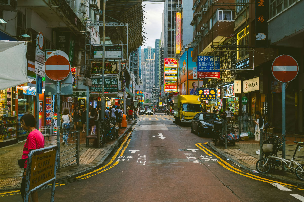
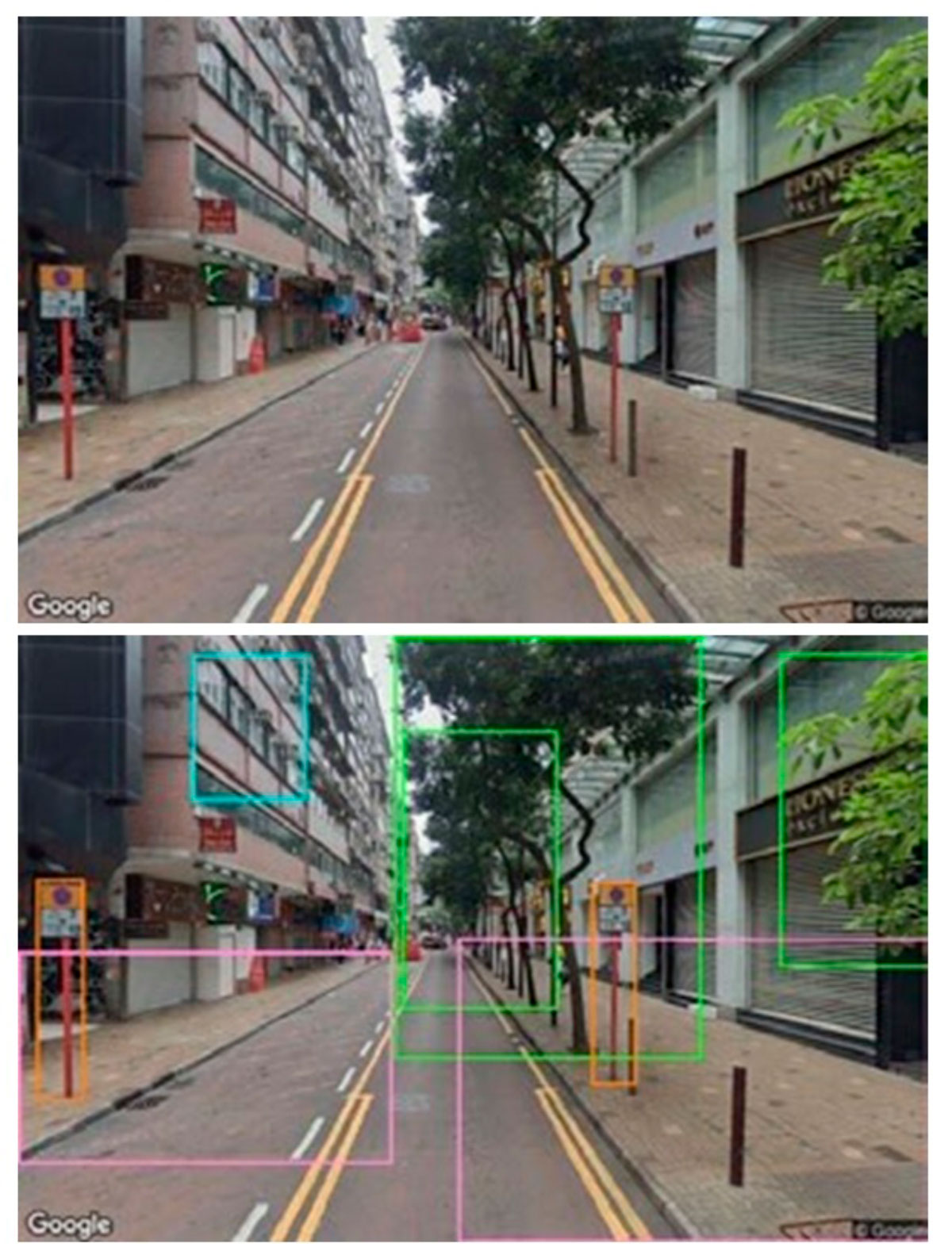
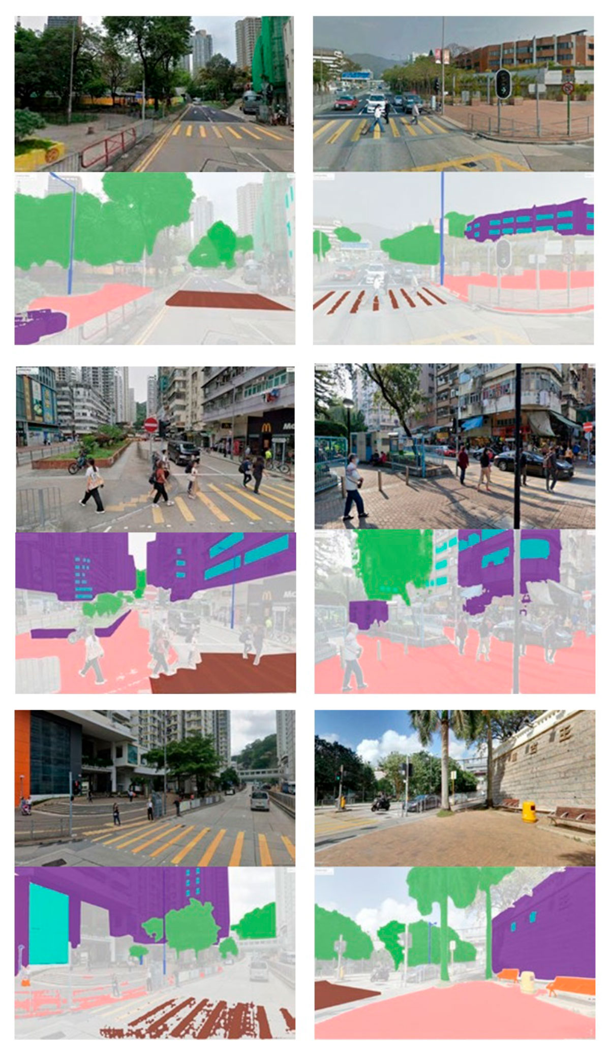
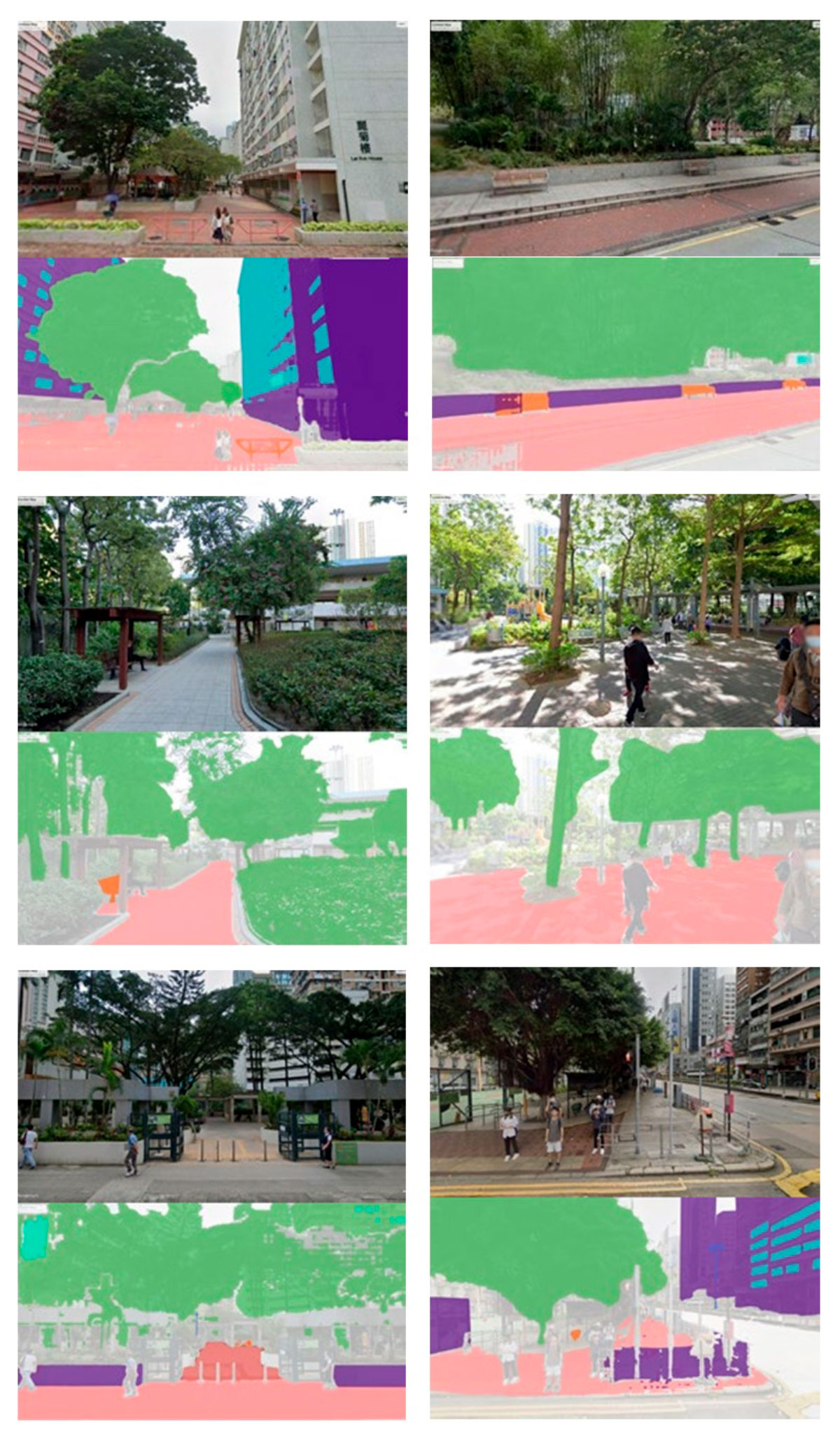
Consequently—and this is one of the first methodological statements—the study, which aims to provide that close-up perspective, quantifies various urban elements based on direct street images taken from a human angle. To “scrutinize the urban elements within the Kowloon district,” the research team specifically used a total of 32,512 images obtained from Google Street View, at 10-meter intervals.
To complete the sources of information on the civic habits of residents in the target district, the research team turned to data from a survey of more than 100,000 residents. It was the Hong Kong government itself that asked its citizens in 2021 about their mobility and transportation preferences—including walking, since, after all, it is just another mode of transportation. Therefore, based on the demographic information of this population sample and data on their mobility behaviour, the researchers established the “walkability index“—or the probability that older adults choose to walk when commuting—in different parts of the neighbourhood, according to the following formula:
Walkability = Number of older adults who choose to walk / Total number of older adults
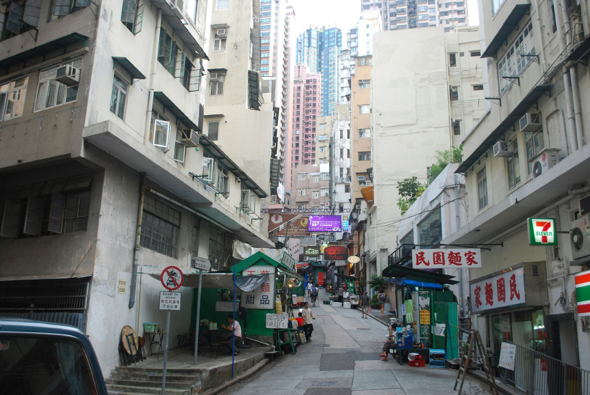
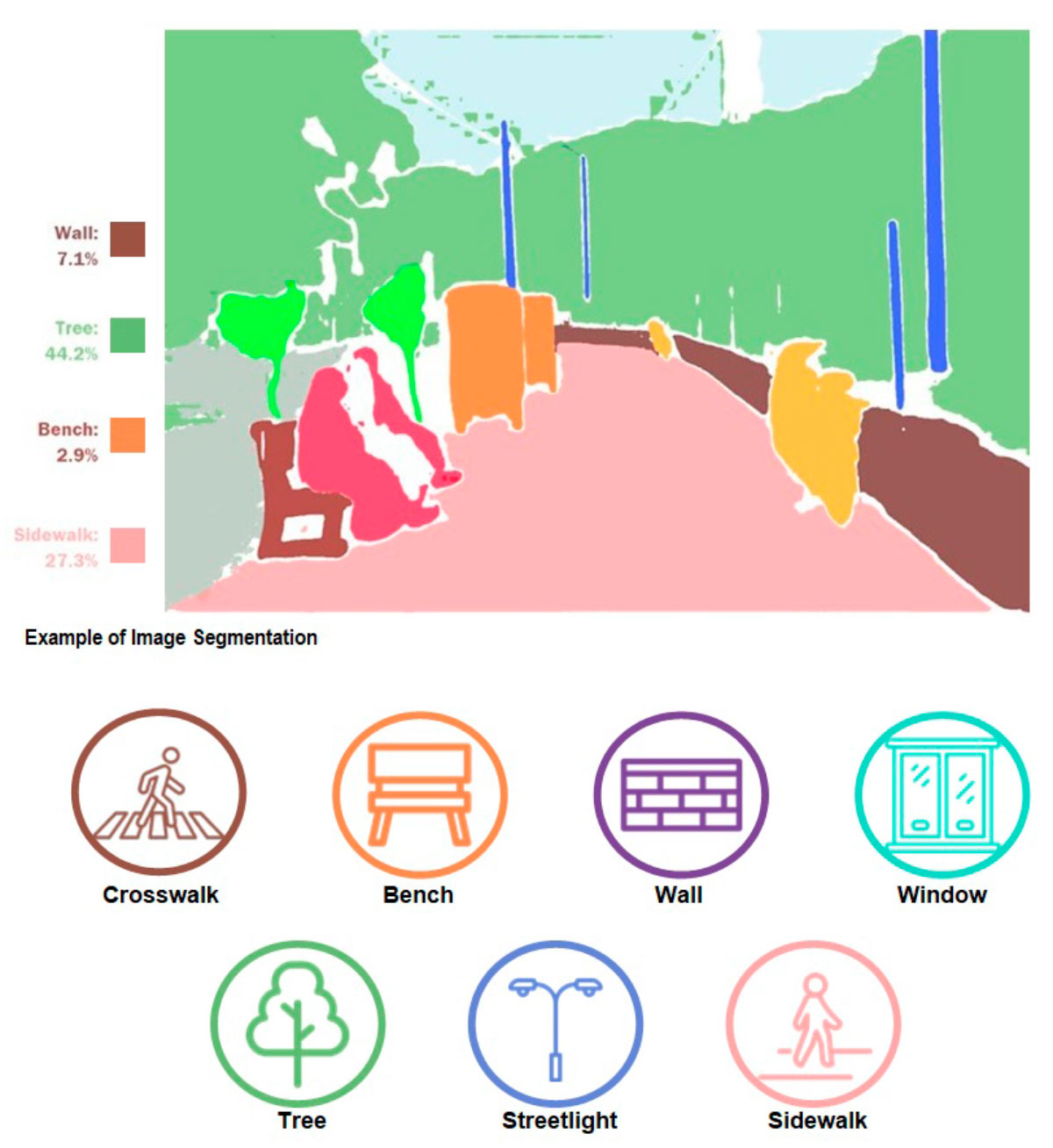
Once this index was obtained for the different parts of the Kowloon district, it was only a matter of correlating it with the various characteristic urban elements present on its streets. For the purpose of the study, the researchers distinguished the following elements of the urban landscape: “crosswalks, benches, walls, windows, trees and vegetation, sidewalks, and streetlights.”
This is where “Visual Artificial Intelligence (AI) methods, like Object Detection and Image Segmentation,” come into play. Using these and machine learning, the research team calculated the percentage of each urban element in the images of Kowloon from Google Street View. And they did so according to the following—expeditious and innovative—formula:
Quantity of an urban element = Pixels of the urban element in an image / Total pixels in it
In this way, they were able to “understand the precise quantitative attributes of urban elements experienced by older adults during walks” and conduct a comparative analysis between urban areas that showed strong correlations, either positive (high presence of urban elements = high walkability, or low presence of urban elements = low walkability) or inverse (low walkability = high presence of urban elements, or high walkability = low presence of urban elements).
The study authors further refined and in-depth their analysis of the correlations between pairs and groups of urban elements and residents’ specific transportation preferences. Ultimately, they established the urban design guidelines we referred to at the beginning of this walk. To keep things brief, we summarize their conclusions regarding the proven facts that improve walkability in cities:
– “When there are more trees and benches together.”
– “Crosswalks and streetlamps paired together.”
– “More façade openings (e.g., windows, patios, balconies) paired with both benches and trees.”
– “Benches paired with both windows and façade walls.”
Credit goes to the studio’s research team, led by Haozhuo Yang, a student at Harvard University’s Graduate School of Design and a Perkins Eastman Fellow in 2023, in the “Design and Wellness” section, in collaboration with Alejandro Giraldo, Hanna Negami, and Emily Chmielewski, members of the architectural firm itself.
Source: Are these streets made for walking? How visual AI can inform urban walkability for older adults.
Images: Perkins Eastman.


